
1
/
of
1
Books for Life
Maryland and Delaware Cruising Guide 2022-2023 - 1912
Maryland and Delaware Cruising Guide 2022-2023 - 1912
Regular price
$100.00 USD
Regular price
Sale price
$100.00 USD
Unit price
/
per
Shipping calculated at checkout.
Couldn't load pickup availability
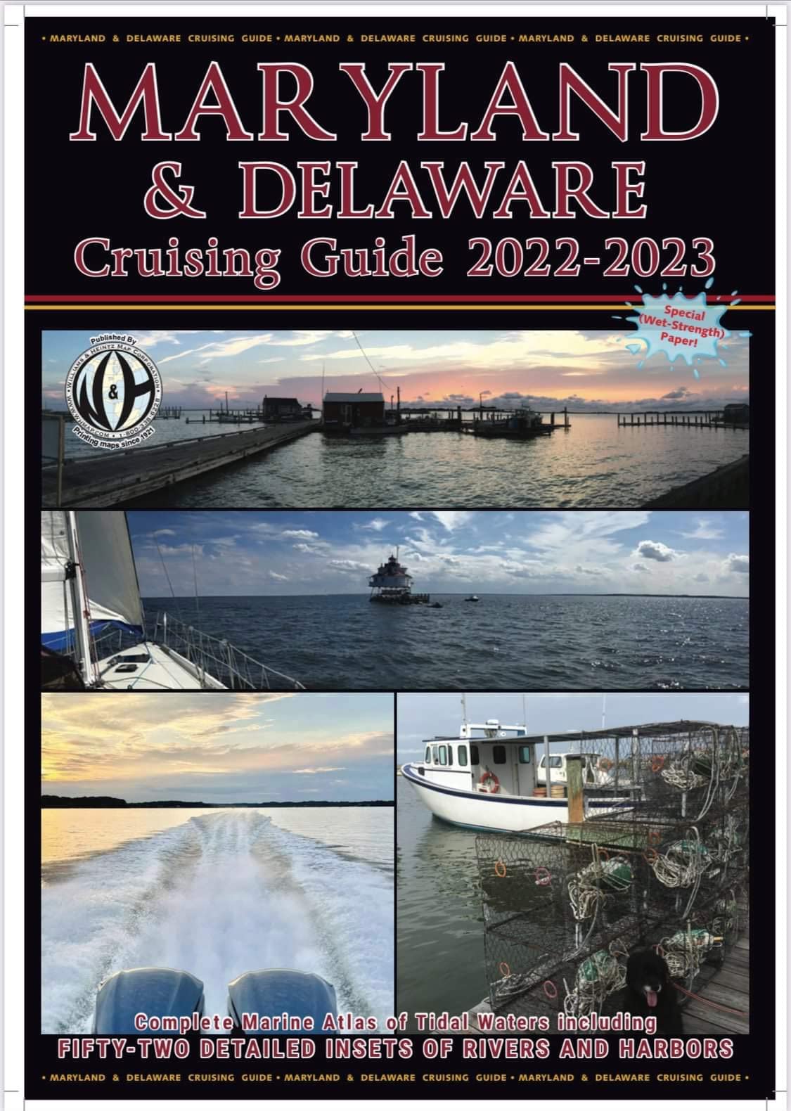
Printing maps since 1921 Plot your course with a Williams & Heintz cruising guide. Based on NOAA's NAD-83 charts, This guide contains up-to-date information about buoys, marinas, ramps and other marine facilities. This Maryland and Delaware Cruising Guide covers the Maryland area of the Chesapeake Bay, the Potomac River as far North as Washington, D.C., the Chincoteague Bay area, includes a large scale inset of Ocean City, and now also includes the Delaware Bay, making it easier to do the Delmarva Loop. Each book is enclosed in a heavy-duty vinyl case to protect it from spray. The pages are printed on high wet strength paper. This paper is just as strong wet as dry. One of the most affordably priced boating guides available!! ORDER HERE! 'The charts in this guide are reproductions of selected NOAA charts. Charts 1 through 21 are at a scale of 1:80,000. The insets are in various scales from 1:40,000 to 1:20,000. The charts were corrected utilizing the information published in the U.S. Coast Guard Local Notice to Mariners through December 2021.' Williams and Heintz printed the very first Guide for Cruising Maryland Waters beginning in the early 1960's for the Department of Natural Resources. Now, new and improved, it is published under the title of Maryland Cruising Guide. This is a complete marine atlas of tidal waters, including over 50 insets of rivers and harbors. This Chart book was the inspiration for the Virginia Cruising Guide. The same standards of accuracy and quality are continued in the Virginia Cruising Guide. CHART INDEX & CHART NUMBER: 1-C & D Canal to Howell Point 2-Howell Point to Swan Point 3-Middle River to Severn River 4-Chester River 5-Sandy Point to Tilghman's Island 6-Eastern Bay, Miles River and Choptank River 7-Choptank River from Choptank River Light 8-Sharps Island Light to Cove Point 9-Patuxent River 10-Love Point to Pont Lookout and Honga River 11-Fishing Bay to Kedges Straits 12-Pocomoke Sound 13-Hooper Strait to Smith Island (Tangier Sound) 14-Potomac River Entrance 15-Potomac River (St. George Island to Breton Bay) 16-Potomac River (Colton Point to Mathias Point) 17-Potomac River (Mathias Pointto Gunston Cove) 18-Potomac River (Mattawomen Creek to Washington) 19-Atlantic Ocean (Fenwick Island Light to Chincoteague Bay) 20-Atlantic Ocean (Winter Quarter Shoal to Chincoteague Inlet)
ASIN: 0999403249
VSKU: LFV.0999403249.G
Condition: Good
Author/Artist:Williams & Heintz Map Corporation
Binding: Map
ASIN: 0999403249
VSKU: LFV.0999403249.G
Condition: Good
Author/Artist:Williams & Heintz Map Corporation
Binding: Map
Share